When you're biking you just appreciate everything more. You appreciate the power of the mountains because of how much effort it takes to get yourself over them, and the incredible speed and wind you pick up on the way down. You appreciate the scenery because you spend a lot of time with it, and you also get to smell the pine trees and literally breathe it in. Rocky Mountain high doesn't just refer to the altitude, but also to the feeling you get being there. There really aren't words to describe it.
Before I start to talk about our ride, I want to define the term 'climb' just because I wasn't familiar with this usage before I started the trip. Climb, when referring to cycling, doesn't mean getting off your bike and going rock climbing. It just means going uphill (or up-mountain). Ways it might be used include: "Dude! That was a crazy climb!" "How much did we climb today?" "How does that climb look on the elevation profile?" So there you have it.
Rockies Day 1:
Our first day in the Rockies, we were going from Golden -- elevation 5600 -- to Idaho Springs -- elevation 7500. You do the math.. there was bound to be some climbing involved. The good news is that Golden and Idaho Springs are only 30 miles apart, so we planned to do a nice, easy 30-mile ride into the mountains that involved a climb of average difficulty. It was supposed to be a gradual warmup to the Rockies. What the Rockies actually did was slap us in the face.
Due to a series of unfortunate events, we rerouted the ride right at the beginning and did 10 extra miles and a completely different mountain... the one that our host told us to avoid because it was "ridiculous." Indeed it was. We did 6000 ft of climbing over 40 miles -- and if you don't have any concept of how much that is, take my word for it, that's a lot, and steep, too. It was really, really tough, but also super exciting.
We did Golden Gate Canyon, which was crazy hard but crazy beautiful, and then Central City Parkway, a super hilly and windy 4-lane highway. The only thing getting me through the day was the incredible views. Sights were literally breathtaking. Cue scenery photos, with the disclaimer that these pictures do not do justice to the experience of actually seeing these views by bike.


One of the most exciting parts of the day was catching the smell of the pine trees in the mountains. It was so fresh and nature-y. I loved it.
MapMyRide (a ride tracking website and phone app) rates climbs based on a combination of factors: distance, grade/elevation change, and maximum elevation, and gives ratings 1-5. Climbs that are too hard to get a rating get "Hors Categorie," a French term that means "above category." We did two HC climbs that day, rated that way for their average grades of over 10%.
Usually the day before we send out an elevation profile of what we'll do the following day, but since we changed the route, this was all a surprise for everyone. But we all did it! It was a great feeling when we found out the extent of what we had actually done.
I was partners with Paul, and we picked up Julie about halfway into the ride too. Riding with only 1 or 2 people was a nice change of pace because it's much easier to keep track of your ride group, and also Paul and Julie are awesome-- Paul for his positive attitude, and Julie for her constant jokes!
We all went to bed early in preparation for a lonnnnng day the next day!
Rockies Day 2:
This day was rumored to be one of the hardest days of the trip. We were to do 90 miles in the mountains, including two major mountain passes: Loveland Pass and Vail Pass in the same day. People travel from all over the world to bike these passes which I think is crazy cool.
We prepared by waking up before the sun at 4:30 and getting on the road at 6 am. Everyone knew what to expect: 2 huge mountains.
The first 20 miles were actually mostly flat, but you could feel the anticipation in the air. Everyone was quiet; I think just mentally preparing themselves for the climb and expecting it to begin at any moment.
The real climbing started around mile 20. I was riding with Sarah who was an awesome partner -- we were about the same pace, and Sarah is always hilarious and in a good mood.
We were already at a high elevation and were going to get to 12000 feet, so we knew that altitude was going to be a concern. We went with the philosophy that it's far easier to prevent exhaustion/dehydration/altitude sickness than it is to recover from one of them. So we decided to take frequent breaks even if we felt like we didn't need them. We forced ourselves to get off our bikes every so often and take some deep breaths with our hands over our heads to get our breathing back to normal, walk around for a few steps, and drink LOTS of water.
We climbed on a trail for 5 miles and then on a road for 5 miles. The trail was beautiful - through the woods next to an adorable creek, with that awesome pine scent really prevalent - and all of the trees kind of shielded us from realizing how high up we were getting. It was also totally silent except for the trickling of the creek (and our heavy breathing, lol). I thought about putting on music to help us get through the climb, but decided the quiet of nature was too pretty to pass up.


I'm sure the altitude was making it hard to breathe, but really it's hard to separate the effects of the altitude and the effects of biking up a giant mountain. However, I definitely noticed it affecting me because I started seeing spots in my vision. I knew that meant I was getting lightheaded due to the lack of oxygen, so at the first sign of spots I always got off my bike to drink water, breathe, and recover. It was better to do that than to keep pushing to the point where I might pass out.
When we got off the trail, we were shocked to see how far we had come. We were almost to the tree line!
We continued the last 5 miles of the climb on Loveland Pass Road, and it was incredible! This part was steeper, and at an altitude of nearly 11,000 feet, it was getting really, really hard on our bodies. We pushed through, and were constantly amazed as we looked back at the amazing views from the side of the mountain. We kept looking down and saying, "wait, we were down there?!? HOW DID WE GET HERE?!"
Finally, we reached the top, at an elevation of 12,000 feet.
The feeling of getting to that summit was so satisfying!! It was the Continental Divide! In case you don't know what that is, it means that any water that falls on the east side of it ends up in the Atlantic Ocean, and any water that falls on the west side ends up in the Pacific. We took pictures with the sign and celebrated with our teammates. We were running around high fiving each other, getting weird looks from everyone that took CARS up the mountain.
The mood was dampened a little by two things. First by a lady at the top that we had the following conversation with:
Lady: "Who are you guys with?"
Us: "We're with the 4K For Cancer!!!!!" *giddy smiles*
Lady: "That's great. I think it's great what you're doing."
Us: "Thanks!!!!!!!!" *giddy smiles*
Lady: "But I think you guys are really rude. Just really rude for playing music up here. People come up here for solitude you know."
Us: ".............."
We turned the music off but that really put a damper on our mood. Because who comes to a major tourist attraction for solitude? Oh and also we had just biked there from Baltimore. So there's that.
To any readers who at some point in the future are considering yelling at kids for playing loud music... understandable, but please check if they just biked 2400 miles first and if so, cut them some slack?
The second thing to put a damper on our mood was a loud thunder clap that occurred while we were at the top. We immediately got on our bikes and raced that storm down the mountain. We knew the roads would get slick so we wanted to beat it!
The descent was just incredible. I don't have any pictures because, well, I was going like 30 mph and hanging on for dear life. There were a lot of tight turns so we had to be super careful! It was a solid 8 miles of fun.
We just barely reached the bottom when the storm caught us. We saw lightning, so we took cover in a strip mall type place and waited it out... for an hour! Rockies thunderstorms are sporadic and usually short, but this one was pretty long.
Eventually we got back on the road and covered the 10 more miles we had until Vail Pass. We passed the following awesome scenery....
Vail Pass was actually nothing compared to Loveland. It was less steep and only 1000 feet of climbing. We crushed it in almost no time :) I have no pictures because my phone was almost dead. Unfortunately, there was no sign on the bike path :(. Only on the Interstate.
Everyone got in very late, and we were exhausted. No one had a problem falling asleep. We were looking forward to the next day... an easy 63 miles, 45 of which were to be downhill!!
Conclusion: I love the Rockies!!!!! I would totally live in Colorado. This state is great!
Before I start to talk about our ride, I want to define the term 'climb' just because I wasn't familiar with this usage before I started the trip. Climb, when referring to cycling, doesn't mean getting off your bike and going rock climbing. It just means going uphill (or up-mountain). Ways it might be used include: "Dude! That was a crazy climb!" "How much did we climb today?" "How does that climb look on the elevation profile?" So there you have it.
Rockies Day 1:
Our first day in the Rockies, we were going from Golden -- elevation 5600 -- to Idaho Springs -- elevation 7500. You do the math.. there was bound to be some climbing involved. The good news is that Golden and Idaho Springs are only 30 miles apart, so we planned to do a nice, easy 30-mile ride into the mountains that involved a climb of average difficulty. It was supposed to be a gradual warmup to the Rockies. What the Rockies actually did was slap us in the face.
Due to a series of unfortunate events, we rerouted the ride right at the beginning and did 10 extra miles and a completely different mountain... the one that our host told us to avoid because it was "ridiculous." Indeed it was. We did 6000 ft of climbing over 40 miles -- and if you don't have any concept of how much that is, take my word for it, that's a lot, and steep, too. It was really, really tough, but also super exciting.
 |
| Our route. Why didn't we take a more direct route? Because mountains. There's usually only one path over the mountains! |
 |
| The water van motivated us with inspirational chalk |


 |
| Golden Gate Canyon State Park |
 |
| Gina and Jared |
MapMyRide (a ride tracking website and phone app) rates climbs based on a combination of factors: distance, grade/elevation change, and maximum elevation, and gives ratings 1-5. Climbs that are too hard to get a rating get "Hors Categorie," a French term that means "above category." We did two HC climbs that day, rated that way for their average grades of over 10%.
Usually the day before we send out an elevation profile of what we'll do the following day, but since we changed the route, this was all a surprise for everyone. But we all did it! It was a great feeling when we found out the extent of what we had actually done.
 |
| Elevation profile.. whaaaat!! |
 |
| Paul & me |
 |
| Miner Street in Idaho Springs! This town was soooo cute! |
Rockies Day 2:
This day was rumored to be one of the hardest days of the trip. We were to do 90 miles in the mountains, including two major mountain passes: Loveland Pass and Vail Pass in the same day. People travel from all over the world to bike these passes which I think is crazy cool.
We prepared by waking up before the sun at 4:30 and getting on the road at 6 am. Everyone knew what to expect: 2 huge mountains.
 |
| Sunrise in the mountains |
 |
| Sunrise over mountains and I-70 |
 |
| Clear Creek, which we bordered for like 40 miles |
The first 20 miles were actually mostly flat, but you could feel the anticipation in the air. Everyone was quiet; I think just mentally preparing themselves for the climb and expecting it to begin at any moment.
 |
| Even the water was super still and quiet! |
 |
| 8500 ft... steadily gaining elevation! |
 |
| Dave in the water van at the first water stop. |
The real climbing started around mile 20. I was riding with Sarah who was an awesome partner -- we were about the same pace, and Sarah is always hilarious and in a good mood.
 |
| Sarah!!! |
We were already at a high elevation and were going to get to 12000 feet, so we knew that altitude was going to be a concern. We went with the philosophy that it's far easier to prevent exhaustion/dehydration/altitude sickness than it is to recover from one of them. So we decided to take frequent breaks even if we felt like we didn't need them. We forced ourselves to get off our bikes every so often and take some deep breaths with our hands over our heads to get our breathing back to normal, walk around for a few steps, and drink LOTS of water.
 |
| Starting to gain elevation from the river! |
We climbed on a trail for 5 miles and then on a road for 5 miles. The trail was beautiful - through the woods next to an adorable creek, with that awesome pine scent really prevalent - and all of the trees kind of shielded us from realizing how high up we were getting. It was also totally silent except for the trickling of the creek (and our heavy breathing, lol). I thought about putting on music to help us get through the climb, but decided the quiet of nature was too pretty to pass up.
 |
| Me realizing we are close to the tree line... this face was supposed to be a shocked face but it turned out... strange, to say the least. I guess that shows how much pain we were in |


 |
| All these small towns were founded as mining towns. Here's a train that's still running! |
I'm sure the altitude was making it hard to breathe, but really it's hard to separate the effects of the altitude and the effects of biking up a giant mountain. However, I definitely noticed it affecting me because I started seeing spots in my vision. I knew that meant I was getting lightheaded due to the lack of oxygen, so at the first sign of spots I always got off my bike to drink water, breathe, and recover. It was better to do that than to keep pushing to the point where I might pass out.
When we got off the trail, we were shocked to see how far we had come. We were almost to the tree line!
 |
| You can see the tree line! |
 |
| Loveland Pass Summit... 4 miles! |
 |
| "Begin Avalanche Area".... well that's reassuring! |
 |
| El mountain |
 |
| Go Sarah!!!! |
 |
| Spectacular view from somewhere on the way up |
Finally, we reached the top, at an elevation of 12,000 feet.
 |
| My altitude app |
The feeling of getting to that summit was so satisfying!! It was the Continental Divide! In case you don't know what that is, it means that any water that falls on the east side of it ends up in the Atlantic Ocean, and any water that falls on the west side ends up in the Pacific. We took pictures with the sign and celebrated with our teammates. We were running around high fiving each other, getting weird looks from everyone that took CARS up the mountain.
 |
| What's up Continental Divide?!? |
 |
| View from the top |
 |
| Chelsea cried the whole way up because she was so happy! Awwwww!! |
 |
| There was snow like a hundred yards away from us at the summit! It was cold!!! |
The mood was dampened a little by two things. First by a lady at the top that we had the following conversation with:
Lady: "Who are you guys with?"
Us: "We're with the 4K For Cancer!!!!!" *giddy smiles*
Lady: "That's great. I think it's great what you're doing."
Us: "Thanks!!!!!!!!" *giddy smiles*
Lady: "But I think you guys are really rude. Just really rude for playing music up here. People come up here for solitude you know."
Us: ".............."
We turned the music off but that really put a damper on our mood. Because who comes to a major tourist attraction for solitude? Oh and also we had just biked there from Baltimore. So there's that.
To any readers who at some point in the future are considering yelling at kids for playing loud music... understandable, but please check if they just biked 2400 miles first and if so, cut them some slack?
The second thing to put a damper on our mood was a loud thunder clap that occurred while we were at the top. We immediately got on our bikes and raced that storm down the mountain. We knew the roads would get slick so we wanted to beat it!
The descent was just incredible. I don't have any pictures because, well, I was going like 30 mph and hanging on for dear life. There were a lot of tight turns so we had to be super careful! It was a solid 8 miles of fun.
 |
| "Trucks stay in low gear - steep grade next 8 miles." Yepppp |
We just barely reached the bottom when the storm caught us. We saw lightning, so we took cover in a strip mall type place and waited it out... for an hour! Rockies thunderstorms are sporadic and usually short, but this one was pretty long.
 |
| Threatening clouds |
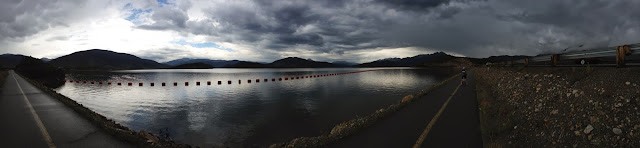
Eventually we got back on the road and covered the 10 more miles we had until Vail Pass. We passed the following awesome scenery....

Vail Pass was actually nothing compared to Loveland. It was less steep and only 1000 feet of climbing. We crushed it in almost no time :) I have no pictures because my phone was almost dead. Unfortunately, there was no sign on the bike path :(. Only on the Interstate.
Everyone got in very late, and we were exhausted. No one had a problem falling asleep. We were looking forward to the next day... an easy 63 miles, 45 of which were to be downhill!!
Conclusion: I love the Rockies!!!!! I would totally live in Colorado. This state is great!
No comments:
Post a Comment